
Itineraries
The Inside Passage, Explained
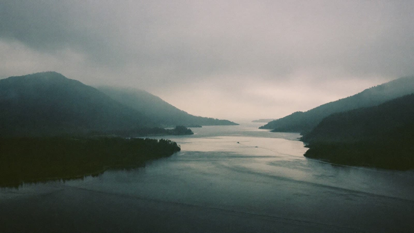
The Inside Passage is the sheltered waterway running roughly a thousand miles from Puget Sound to Southeast Alaska, threaded between thousands of islands and the mainland. It is why Alaska cruising is calm, why the ports exist where they do, and why the scenery is continuous rather than occasional.
The short answer
The Inside Passage is a network of sheltered channels running about 1,000 miles between the Pacific Northwest and Southeast Alaska, protected from ocean swell by a chain of islands. Cruise ships use it because it is calm, scenic and connects ports that have no road access. Almost all Alaska cruises spend most of their time in it.
Key points
- A sheltered route about 1,000 miles long, protected by thousands of islands.
- Calm water, which is why Alaska cruising rarely involves rough seas.
- Scenery is continuous rather than occasional, unlike open ocean cruising.
- Queen Charlotte Sound is the one genuinely exposed section.
- The ports on the route have almost no road connection to anywhere.
If you look at a chart of the coast between Seattle and Skagway, you see something unusual: a continuous ribbon of protected water threading between the mainland and a scatter of thousands of islands, almost never open to the Pacific. That is the Inside Passage, and it is the reason Alaska cruising works the way it does.
What it is
The Inside Passage runs roughly a thousand miles from Puget Sound in Washington State, north through British Columbia, and into Southeast Alaska. It is not a single channel but a network of them, and vessels have used it for thousands of years, first by Tlingit, Haida and Coast Salish peoples, later by fur traders, gold rush steamers and now by ferries and cruise ships.
The islands are drowned mountain tops. During the last glaciation the ice sheet carved deep valleys through the coastal ranges, and when sea level rose the valleys flooded, leaving peaks as islands and troughs as channels. That is why the water is so deep so close to shore, and why the coastline is so intricate.
Why cruise ships use it
Three reasons, in order of importance.
It is calm. The island chain blocks Pacific swell for most of the route. A ship in Chatham Strait or Stephens Passage is in effectively enclosed water. This is why Alaska cruising, despite its northern latitude, is among the calmest cruising anywhere. See seasickness on an Alaska cruise.
It connects the ports. Juneau, Ketchikan, Sitka and Skagway have almost no road connection to the rest of North America. The passage is their road.
It is continuously scenic. On an open ocean crossing you look at water. Here there is land on both sides for most of the route, often close enough to see individual trees, with fjords opening off it and glaciers visible at the heads of some of them.
The route, section by section
| Section | Character | Notes |
|---|---|---|
| Puget Sound and Strait of Juan de Fuca | Open but sheltered | Leaving Seattle, with the Olympic Peninsula to the south |
| Strait of Georgia | Wide and calm | Between Vancouver Island and the mainland |
| Johnstone Strait | Narrow, forested | Excellent orca habitat |
| Queen Charlotte Sound | Open ocean | The one exposed section, usually crossed overnight |
| Hecate Strait and Grenville Channel | Narrow and dramatic | Grenville is 45 miles long and barely half a mile wide in places |
| Dixon Entrance | Semi exposed | The Canada to United States boundary |
| Clarence Strait and Chatham Strait | Wide and calm | Southeast Alaska proper |
| Stephens Passage and Lynn Canal | Deep fjord | Lynn Canal is one of the longest and deepest fjords in North America |
The one rough bit
Queen Charlotte Sound is a gap in the island chain, roughly 30 to 50 nautical miles of genuinely open water between the north end of Vancouver Island and the mainland. Ships are exposed to Pacific swell for three to six hours.
Almost every itinerary crosses it overnight, which means most passengers sleep through it. If you are prone to motion sickness, this is the section to be aware of, and lying down is the best position to be in anyway.
What you actually see
The Inside Passage delivers scenery in a way that is easy to undersell, because it is not dramatic in the manner of a single enormous glacier. It is cumulative.
- Forested islands receding into mist in successive layers, which is the classic Southeast Alaska image
- Waterfalls on steep walls, often dozens visible after rain
- Fjords opening off the main channel, including Tracy Arm and Endicott Arm
- Whales, most commonly humpbacks, with orcas in Johnstone Strait
- Bald eagles, near constant
- Sea otters, particularly toward the northern end
- Bears occasionally on shorelines, more often in August during salmon runs
- Small communities and fish camps, visible from the water
Grenville Channel
Worth staying up for if your itinerary transits it in daylight. Forty five miles long, walled by steep forested slopes, and narrow enough in places that the ship seems to fill the channel. It is the single most enclosed stretch of the whole route and it feels considerably more remote than the ports do.
Inside Passage versus Gulf of Alaska
| Factor | Inside Passage round trip | Gulf of Alaska one way |
|---|---|---|
| Water | Sheltered throughout | Includes open ocean crossing |
| Ports | Ketchikan, Juneau, Skagway | Same, plus Hubbard and College Fjord |
| Flights | Simple return | Open jaw, 10 to 30 percent more |
| Denali extension | Not directly | Natural continuation |
| Seasickness risk | Very low | Moderate for a day |
| Typical price | Lower | 10 to 20 percent higher |
For a first Alaska cruise, the Inside Passage round trip is the right choice. For a second visit, or if you want to continue to Denali, the Gulf route adds genuinely different content. See northbound versus southbound.
How to enjoy it
The Inside Passage rewards the sea day. Rather than treating the second day of the cruise as time to explore the ship, spend part of it on deck or in a forward facing lounge with binoculars.
The best light is early morning and late evening, and in June both of those last for hours. The best position is forward and high, or on a wraparound promenade deck if your ship has one, which Holland America Vista and Signature class ships do.
Frequently asked questions
What is the Inside Passage?
Is the Inside Passage rough?
What can you see along the Inside Passage?
What is the difference between an Inside Passage cruise and a Gulf of Alaska cruise?
Related articles
Onboard
What to Do on an Alaska Sea Day
How to use a sea day on an Alaska cruise, why they are different from warm weather sea days, and what is actually worth doing.
Updated
Destinations
A Day in Glacier Bay, Hour by Hour
What a Glacier Bay cruise day is actually like hour by hour, from rangers boarding at dawn to the afternoon transit out, and how to make the most of it.
Updated
First Timers
The Best Alaska Cruise for First Time Travellers
Which Alaska cruise to book for a first visit, covering line, route, month, cabin and the specific booking we would make ourselves.
Updated